Cuzco: Into the heart of the Inca Empire

Monday, September 27, 2010 by Sarah
We arrived into Cuzco, bleary-eyed, just after 6:30, following our overnight bus journey from Arequipa. We headed straight for our awesome hotel, El Balcon, which we were staying in courtesy of Will and Sophie, who'd paid for our stay as an engagement present (thanks again guys!). The hotel boasted spectacular views over the red rooftops of the city – it put me in mind more of an Italian village than central Peru! I was expecting Cuzco to be a one-street tourist trap, existing only to sell tours and alpaca hats to tourists passing through en route to Machu Picchu, but it quickly became apparent that I was very wrong. Cuzco is in fact the oldest continually inhabited city in South America, and was the most important city of the Inca Empire, where most of the civilisation's rituals and ceremonies were held. Little wonder then that the Spanish felt it necessary to make their mark during the conquest.

We just had time for a quick shower and breakfast before Pete and Claire arrived from Lima. It was so fantastic to see them and catch up on all the news from home – James and I got a bit carried away, and ended up talking at them for an hour before we realised they hadn't even yet had time to check in to their rooms!

Cuzco stands at 3400m above sea level, and so we'd planned in a couple of fairly restful days to adjust to the altitude before commencing our Inca Trail trek. We started with a leisurely lunch in a cafe overlooking the Plaza de Armas, watching the locals pass by in the sunshine. Eventually we decided that we'd probably better make at least an attempt at sightseeing, and so we headed across the plaza to the cathedral, which turned out to be three churches in one! We admired a statue of Black Jesus (no really!), and choir stalls featuring women with potatoes for stomachs, along with another painting of the Last Supper with guinea pig on the menu. It's been very interesting to see the combination of the traditional Andean religion and Spanish Catholicism – it seems that the Spaniards were happy for some local beliefs about Pachamama (Mother Earth) and other animistic rituals to continue, provided people fit them into the framework of the Catholic faith. At any rate, they seemed to achieve a compromise fairly well – the Virgin Mary is often pictured wearing an enormous dome-shaped dress, a subtle hint towards the traditional mountain shape of Pachamama.

We also paid a visit to Qorikancha, an ancient Inca site converted by the Spaniards into the Church of Santa Domingo. The site was originally the central temple of the whole of Incan empire, created to worship the Gods of the Sun and of the Moon. When the Spanish arrived, they demolished the most important parts of it and rebuilt a Catholic church on the same site, but left other, smaller temples, to be used as dressing and preparation rooms by resident priests. Originally the outer Inca walls would have been covered in gold – what an amazing site must have greeted the Spanish on their arrival. The surviving structures today are still pretty spectacular - a hybrid Inca/Spanish site which dominates a whole quarter of the city. We found the famous Inca stonework particularly impressive – perfectly tessellating blocks of stone that have withstood hundreds of years of earthquakes whilst the modern buildings around them crashed to the ground. Our tour of the site was conducted by a Spanish woman with heavily accented English – she kept referring to 'Hypotetica' who we all thought was an ancient Inca King, until we realised she was actually saying hypothetically!

Cañón del Colca: Lair of EVIL condors

Sunday, September 26, 2010 by James
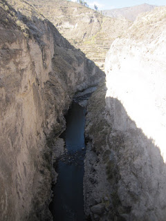
The Colca Canyon is the world's second deepest canyon. In parts it's over 3000m deep, deeper than the Grand Canyon and second – by only 163m – to its less accessible neighbour, the Cotahuasi Canyon. The fertile soil somehow clinging to its less extreme upper reaches also made it the bread basket of the Incan Empire. By carving thousands of terraces into the sides of the valley, they were able to grow grain and fruits which were then transported by llama to feed the masses in important centres like Cusco.

To get to Colca Canyon we took a two day trip up out of Arequipa, over the high Andean plains of the Altiplano before descending down to Chivay, the capital of the region which lies at the head of the canyon's river valley.

The road north west out of Arequipa passes underneath the dormant volcanic mountain Chachani. A massive shanty town has been built at its base, thousands of houses all built from rock hacked from the lava fields that Chachani laid down hundreds of years ago. The town's inhabitants are a mixture of economic migrants from the last 10 years and earlier political migrants who were escaping the machinations of the Shining Path movement in the 80s. Driving through we saw that the upcoming Peruvian elections definitely hadn't missed the shanty towns out. Giant slogans in primary colours were daubed all over the walls of roadside houses.

Once we left the shanty towns, the road wound further around the base of Chachani cutting directly through big rollers of solidified lava, and slowly up towards the altiplano. The plants of the Andes are specifically adapted to certain elevations, so you drive through bands of different coloured grasses, desert and scrub until you find yourself on the high plains at last.

Once there you're no longer alone. Vicuñas, Alpacas, Llamas (and even the odd migrating Flamingo) all call the Altiplano home. It can be hard to tell these cameloids apart, so here's a bluffer's guide:

1. Vicuñas. Deer like creature with a loping run, a long neck and fine fur. They only come in one colour, a sandy brown. Vicuñas cannot be bred in captivity as the males are too violent. This is a shame as their fur is finer than even human hair, and one jumper made from vicuña wool currently retails for around $1500.

2. Llamas. The favourite animal of the Incas. Used for food, transporting goods, for clothing, for candles and for sacrifices. The llama is much heavier-looking than the vicuña and has coarser wool. They come in many different colours, from black to brown to piebald. Llamas are known for their strong personality – load one with more than 30kg and it will simply lie down and refuse to move. Kick it in the hope of making it get up and it will spit at you.

3. Alpacas. Descended from wild vicuñas, these now look more similar to the llama, but have a smaller head, narrower body and finer wool. Alpacas tend to have a more consistent colour than llamas. Alpacas can also spit, but tend not to.

The altiplano is around 4200 to 4900m asl. To combat the altitude our tour guide handed us all a wadge of coca leaves to chew on the bus. The raw ingredient of cocaine, unfortunately there's only about 1mg of the opiate per 10kg of leaves. They do have about 14 other active ingredients though, all of which help alleviate the effects of altitude sickness. Interestingly, one of these chemicals is a mild anaesthetic so as you chew your mouth goes slightly numb. This had the unfortunate side-effect of making me dribble out of the side of my mouth like I'd just come back from the dentist. Considering that the leaves turn your teeth and spit a lovely dark green colour too, this may preclude my enjoying coca amongst polite company.

The end of our bus ride was the town of Chivay which sits near the start of the canyon. Shortly after arriving we went for a hike to see the actual 'colcas' which give the canyon its name. Colca means storage house in the Incan Quechua dialect. The colcas of the canyon are unique in that they were built into the walls of the canyon itself. This made them very difficult to get to, but had the benefit of keeping them in wind and shade for most of the day. Down in the canyon their temperature stayed sub zero even in the height of the Andean summer – perfect for storing fruit, meat and grain.

We hadn't really driven all day just to see a 15th century refrigerators though. The main reason people come to Colca is to see the condors. Further down the valley where the canyon reaches its deepest, strong thermals form in the mornings and evenings which are ideal for the lazy cruising flight of these birds. Many nest in the canyon walls and soar around the area in the morning before heading further down the valley (even as far as the coast – over 100km away!) to hunt.

We woke up early to drive out to Cruz del Condor for 8am when the young condors are most active. We were lucky. After 3 hours of gravel roads, we arrived to find 3 young condors soaring around the canyon which were soon joined by several more. They were a complete joy to watch. In the hour we stayed they wheeled around us, diving and swerving seemingly for the sheer fun of it. The younger birds were more curious, and occasionally one would do a 'fly-by' just over the tops of our heads, eliciting shrieks of delight and fear from the tourists.

The only thing taking the edge off the experience was our finding out, a few minutes prior to seeing them, that condors are actually vultures and exclusively eat dead things. And not newly dead things either. Once they spot a dead animal, they wait for about two weeks until it's semi-decomposed before eating it. This is not the noble creature I learned about from Mysterious Cities of Gold. Speaking of which...

AREQUIPA! AREQUIPA!

Friday, September 24, 2010 by Sarah
We arrived in Arequipa after a 10 hour Cruz del Sur bus journey from Nazca. Both exhausted, it was a surprise and a delight to find we appeared to be staying in one of the nicest hostels of the entire trip. This was confirmed the next morning at breakfast, when we had a choice of four different cereals, three different yoghurts, delicious bread, cheese and ham. I am not ashamed to admit I was close to tears: amazing the things you miss when travelling, but cereal is pretty much at the top of my food list. I made sure I had 2 bowls every morning to satisfy my cravings.

Arequipa is a beautiful city, famous for its 'sillar' buildings – a blindingly white volcanic rock – and is a World Heritage Site by dint of this fact alone. We started our exploration in the Plaza de Armas, which seems to serve as a meeting and hanging out point for the local population – it was buzzing early on a Friday morning, and by the afternoon you could barely move for people. The square is dominated by the cathedral, which was decimated by an earthquake in the 19th century and has since been completely rebuilt in neo-classical style. It's pretty stunning, although the views from the rooftop were even more impressive. Arequipa is surrounded by 3 volcanos – El Misti (5822m), Chachani (6075m) and Pichu Pichu (5571m) and the 360 degree vista was pretty spectacular.

Our next stop was the Museo Santury (sic), home to a 500 year old mummy called Juanita, found by an American near the top of Mount Ampato (6288m) in the mid-1990s. Juanita was a 15 year old girl offered as a sacrifice to the gods by the Incas, which apparently was a fairly common ritual towards the end of the empire's reign (prior to that, only animals and other precious artifacts were made as offerings – things were clearly getting pretty desperate at that point!). It sounds pretty brutal – she was walked 580km from Cuzco to the mountain, fed copious amounts of alcohol and then killed by a blow to the head, before being left on the mountainside – but in fact being selected as a sacrifice was a very great honour, and rich Inca families petitioned for their children to be chosen. As a result of the icy conditions Juanita was left in, her body has been almost perfectly preserved, including her hair and skin, although she has to be kept in what is essentially in a freezer to avoid further decomposition. Seeing her tiny body (she was about 4 foot 10) was a pretty creepy sight, and reminded me just how little we know about the Inca civilisation and their traditions.

We spent the afternoon at the Monasterio Santa Catalina, a Dominican nunnery founded in 1579 which was designed to be a 'city within a city.' We were a little disappointed that the stories of saucy nuns that lured us in were completely unfounded, but were nevertheless blown away by the place. It was vast, with 5 'streets,' a cemetery, a laundry and lovely gardens. In its heyday, there were some 175 nuns in residence, and it is still in operation today, albeit on a much smaller scale – there are about 40 nuns living on site, ranging in age from 18 to 90! Traditionally the second daughters from rich Spanish conquistador families were sent to the nunnery at the age of 12, where they would remain until they died – parents believed that they would be more likely to go to heaven if they had a religious daughter! The girls were kept in solitary confinement for four years, speaking only to the nuns who taught them to read and write, before they were allowed to enter the convent proper.

But it wasn't all bad. The families usually paid for the daughters to have enormous rooms filled with the finest furniture and china, and each nun could have up to 5 maids who prepared their meals (each nun had an individual kitchen) and kept house for them. Wandering through the gorgeous complex, all brightly painted red and blue walls and geraniums everywhere, it was fascinating to see the degree of individuality between the different rooms – and also the discrepancy between the financial circumstances of different nuns, visible from whether the doors to their rooms were carved or plain. Local bishops tried several times to make the nuns live a more ascetic life, but when they finally succeeded, forcing the nuns to adopt communal living patterns, over half of the nuns opted to quit the convent altogether!

Today's nuns are all there voluntarily, and have slightly more access to the outside world than their predecessors. They have microwaves and the internet, receive news every Sunday and can leave the complex to go to the doctor, the dentist or to visit sick relatives – but only accompanied by another nun, just in case they find themselves tempted by the evils of the outside world. It must be a beautiful place to live, but definitely not for me!

Nazca: A long wait for a short flight

Wednesday, September 22, 2010 by Sarah
The Nazca Lines are something of a mystery. Discovered in 1911, they are believed to be the work of a pre-Inca tribe, although no one is quite sure what they were designed for: a stellar constellation map, a tribute to the gods, or a water divining system? Whatever they are, we were keen to see them for ourselves.

This was going to be our first proper experience of the Peruvian tourist industry, and we had been warned that their approach to tourism was a little more relaxed than we've been used to. Stories of long waits and bun fights for planes were not uncommon. And so we awaited our pick-up prepared, armed with lots of water and reading material. Our guide Oscar greeted us with the news that as a result of early-morning fog, flights were already running 2 hours behind – putting our scheduled 11am flight back to 1pm. He insisted we should still head to the airport, just in case things sped up again.

At the dedicated Nazca Lines airstrip, we were greeted with a waiting room full of tourists – more than we'd seen since our arrival in South America. There were an astounding number of Japanese tourists, all of whom had opted to take an hour long overflight, rather than the standard 30 mins. This delayed our flight further – estimated flight time now 2pm.

We watched the American documentary called “Digging for the Past” or something equally trite, and laughed a lot as the Indiana Jones wannabe presenter tried to shed some light on the reason for the Lines' existence. Miraculously, he also 'discovered' some new lines on his very first flight! However, having seen it 3 times through, we were starting to get a little bored. It was at this point our guide took pity on us and drove us back into the town centre to get some lunch. Estimated flight time now: 3pm.

We returned to the airstrip at 2.30, by which point I was getting pretty nervous about our flight – never a fan of small planes, our experience in New Zealand had made me question getting in another small plane at all. And yet still we waited, another 2 hours to be precise. By the time our flight was called, at about 4.30pm, I was a sweating, nervous mess. Gripping James's hand tightly as we sat in the plane, I tried to quash my fears and shut my eyes as we taxied the runway.

And then we were in the air! The next 25 mins passed in a blur as our pilot careened first one way and then the other, allowing both sides of the aircraft a good view of each set of lines in turn. This was a good idea in theory, but the sharp jerky movements of the plane soon made us both feel pretty nauseous. With each call of “Left side! Right side!” I found myself desperately seeking out the horizon – no mean feat when the plane spent most of the flight at a 45 degree angle.

All that said, the Lines were pretty awesome to see, and an overflight really is the only way to see them. It was amazing to suddenly be flying over all these intricate lines, carved into the sand of the desert. My favourites were spider, which was incredibly detailed, and hummingbird, which was enormous. Still it was baffling to consider why these lines were here at all – the German archeologist Maria Reiche spent her whole life trying to unlock the mystery of the lines. Flying over them, I began to see why.

And then almost before we knew it, we were heading back for the runway, for an incredibly smooth landing. Glad as we were to have seen them, my overwhelming feeling being back on solid ground was relief. And a little nausea.

The cabbie turned to us with eyebrows raised: 'Why are you staying in Ica?!'

Tuesday, September 21, 2010 by James
...he had a point. Ica is well and truly off the gringo trail. It's a tumbledown town consisting of a busy central plaza and a warren of narrow cobbled and dirt streets, all of which are jammed with tiny Daewoo Tico taxis – all of which have cracked windscreens – and pimped tuk-tuks with fake Nike-branded canopies and UV downlights.

Aside from soaking up some of this bizarro authentic Peruvian culture, there are only three reasons to visit.
1. It has the best pre-Incan musuem in Peru
2. It's near to, but is not Huacachina, an oasis town / tourist black hole nestled inside giant sand dunes
3. There surrounding countryside is famous for its Pisco distilleries

Our first day in town we took a taxi to the musuem. The taxi was a Daewoo Tico, of course, but is worth mentioning for its unique interior decoration. It had sun visors on both the top and bottom of the windscreen, reducing visibility to a 6 inch strip through which its driver glanced distractedly from time to time, and every square inch of the rest of the interior was covered with an array of interesting stickers: amongst the collage we spotted Mickey Mouse, Homer Simpson and Jesus.

Tough for any museum to follow that ride. When we arrived and paid to get in, they had to turn on the lights and air conditioning for us. It seems there aren't that many visitors these days, which is strange given the number of interesting artifacts still housed there. I say 'still', as in 2004 a number of these interesting artifacts were stolen, so now in between the vases and mummies there are giant 'wanted' photos of the missing pieces.

Unsurprisingly, one section that was left well alone by the thieves was the mummy exhibit. This consisted of a number of skulls, skeletons and fully intact mummies buried by pre-Incan and Incan societies. The burial customs and cold dry climate of Peru are perfect for preserving bodies, so many of the mummies still had skin, hair and fingernails. One had awesome dreadlocks.

From the museum we caught another Tico out to Huacachina – a quick 5km away from Ica. Almost as soon as you get out of town, huge sand dunes rise up out of the desert like waves. It's probably all in my head, but I could have sworn you could see them moving, shifting shape and creeping towards the city. The road that wound around them down into the oasis town was swallowed up in parts by the sands.

Huacachina is definitely ON the gringo trail. As we pulled into town, we heard the straining sounds of Liam Gallagher coming from a nearby bar (Oasis – get it?), and every couple of minutes we were offered sand boarding, 4x4 rides or pizza. The first two options seemed a bit too much like hard work in the desert heat, so we settled for option 3; pizza, in a nice bar by the side of the lake. The town is made up of a collection of restaurants, bars and hostels crowded around the oasis with their backs to the dunes. Unfortunately for some reason the lake smells of urine, so after a quick lunch we left and headed off in search of booze at one of the many pisco distilleries in the area.

The first bodega (Spanish for winery) we went to was shut, but our taxi driver 'knew a place' and drove us out into the sticks to find it. We drove about 20 minutes out of town, down dusty roads through mud brick villages and bone dry fields. Lots of wild dogs and suspicious locals. We were getting just a little bit nervous about our destination when we arrived at a small but well run bodega.

Pisco is made from grapes that are harvested once a year in March, so whilst we were able to try a range of spirits, the actual distillery wasn't running. Even if we had been in season, the actual modern distillery is shut to the public – instead we got to see the traditional stone press and still. Nonetheless, the process was fascinating. Grapes used to be juiced by foot and wooden press, and the resultant liquid poured into amphorae that were left out in the sun to ferment. The strange shape of these jars enabled the sediment to settle out of the liquid as well as providing a solid base to withstand the frequent Peruvian earthquakes (more of which later). Having fermented for a couple of weeks, the mildly alcoholic liquid was poured into a giant stone pot still and heated to distill and produce the finished pisco. This was definitely the most rustic distillery I've seen, and you can taste this roughness in the finished liquid. Sarah and I tried the full range of piscos and wines from the bodega, and were beginning to sway a little by the time we piled into the cab to go home. Our favourite was a pisco known locally as 'Baby maker' – due to the effect it has on the local population 9 months after its release each year.

After the afternoon drinking we decided to have an early night; however it wasn't quite as restful as we had hoped. We both woke up at 3.45 to find our entire room shaking from side to side. Earthquake! We jumped out of bed, and remembering our earthquake survival skills from TV, ran to stand under the doorway. Retrospectively, I realised this would have been a more effective response had I put some clothes on first. As it was, I was starting to consider having to make a nude escape into the street when the shaking stopped. I quickly fell back to sleep, leaving Sarah awake for the rest of the night to worry about aftershocks and watch BBC News 24 for “breaking news” of the earthquake. Luckily there were none, and no mention on the news either. In the taxi to the bus station the following morning the cabbie casually told us that it was only a 5.7 and that it had hit Chincha, 100km north of Ica. No-one was badly hurt, and due to cleverly shaped amphorae no pisco was spilt either.

Fear and Loathing in Lima

Monday, September 20, 2010 by Sarah
We were a little trepidatious about journeying to Lima: the Lonely Planet is filled with stories about muggings and unsafe streets, and almost every entry about a museum is followed by “get here in a taxi from.....” As a precaution, we'd opted to stay in the affluent suburb of Miraflores, about 7km from the city centre. Our hostel was run by a lovely family and their dog Perdi, who took an instant shine to James: on several occasions during our 2 night stay I had to prise James away from playing fetch with a marble with the dog in the corridor. I think he's missing Blacky.

Tired after our early flight from Santiago, we decided to hang out in Miraflores for the day. We had lunch in a packed local cafe. Menu del dia = 2 courses and a drink for the princely sum of £1.60. Towards the end of the meal the elderly guy at the next table leaned over and starting talking to us in perfect English: turned out he had been married to an Englishwoman and lived in New York for years, retiring only a couple of years earlier to his native Peru. He was very proud of his neighbourhood, and told us all about his local community centre that organised weekly trips for him and his fellow retirees. It was at this point we started to relax, and thought that perhaps we might enjoy our stay here......

After a little nap, I was keen to see something of the 'local sights' so we caught a cab to the Museo de la Nación, which according to the guidebook was a 'treasure trove' of pre-Incan artefacts. We arrived just half an hour before closing time, but as it turned out this was enough: the seven storey building was almost totally empty! Restoration work is apparently underway, although from the looks of things it'll be a long time before the place is up and running again. There were a couple of temporary exhibitions open, but it was a slightly surreal experience wandering around the concrete edifice trying to find them – no one seemed to want to point out the way. Eventually on the sixth floor we found an exhibition: a photographic retrospective of the horrendous violence which Peru saw during the 1980s as a result of the Shining Path, a Maoist-communist terrorist organisation led by university professor Abimael Guzmán. I think BBC News has been sheltering me for the last 27 years as many of the images we saw were horrific.

Sobered as a result of this experience, the next day we headed into the city proper. We decided to brave the bus, which was a pretty intense experience. Lima appears to be overrun with competing bus companies offering cheap transport around the various districts. As a result, the companies all vie for the custom of passing pedestrians: as well as drivers, each bus has a conductor who hangs out of the door of the bus, shouting the destinations and encouraging anyone and everyone to climb on board. There was a lot of crazy driving, lane changing and horn beeping – felt very much like being back in China or Vietnam. But we made it!

Central Lima is vast and sprawling: it's a city of 8.5m people spread out over 2,670km. It's pretty hard to get your head around. James said it reminded him a lot of Mexico City, although to me, the central squares were again pretty European in feel. The Plaza de was very impressive, surrounded by the ornate Archbishop's Palace, the Governmental Palace and the bright yellow buildings with ornate wooden balconies which appear to be something of a Lima trademark: apparently there are some 1600 of them in the capital! Fortunately all the tourists sights are clustered pretty close together, so it was a short walk to the Church of San Francisco. This church has an incredible library with books dating back to the 16th century and gorgeous curved staircases, and a mural of the Last Supper which sees Christ and his Apostles chowing down on guinea pig, a local delicacy.

But the best bit was the catacombs: open to the public since 1850, this sprawling space under the cathedral houses the remains of 25,000 people – first buried in separate plots and later just thrown into an enormous well which has bodies 10-deep. When the church opened to the public in the 1850s some bright spark decided it would be nice to to sort and arrange the top layer of bones into an attractive pattern, so today all the femurs and skulls are presented in neat little rows. It's pretty creepy.

We had lunch at Norky's, a local fast-food eaterie which was packed with families enjoying a Sunday meal together. It was here that we discovered that Peruvians love to eat: a meal for four consists of two whole chickens, an enormous plate of chips and a bottle of the local delicacy, Inca Cola. This bright yellow, super-sweet liquid tastes a bit like limeade but is the drink of choice here: a quick survey of the room showed bottles of Inca Cola outnumbered regular Coca Cola at least 3:1. It's no wonder that Coke bought the brand in 1999. Allegedly Inca Cola is soon to be sold in Europe, although we can't really see it taking off. We tried to order just a snack, but even my 'lighter option' chicken and salad was enough to feed about 3 people....

We were on guard throughout our time in the centre of town, although other than James being offered cocaine (I blame the beard) we had no problems. Heading to Lima's Modern Art Museum was a bit of an experience though: situated in a park surrounded by a high iron fence, we had to ask permission to enter from an armed guard who took his job very seriously. Clearly we made the grade as we were allowed in, but there were many locals who were left outside. The MALI was another stunning building, and we really enjoyed the exhibit about Gordon Matta-Clarke, a slightly unhinged American who in the 70s used derelict buildings as his canvas, knocking giant holes in their ceilings and walls and recording it all on film.

Our last morning in Lima was spent at the Huaca Pucllana, a pre-Inca site founded by the Lima tribe and allegedly used as a temple to worship the gods of the moon and the sea. It is currently being 'excavated' although 'rebuilt' seems a more appropriate description: allegedly only 30% of the site has been reconstructed but it looked so perfect, we found that hard to believe. Apparently the temple site was neglected until the early 90s, at which point it was being used as venue for drug dealing, prostitution and even dirt-bike competitions. Of course more recently the government has started taking the many Peruvian ruins more seriously (because ruins = tourists = money). It was well worth a visit, and has definitely whetted our appetites for the Inca Trail!

Viva Valpo

Thursday, September 16, 2010 by James
Travelling beyond the sprawl of Santiago towards the coast is a downhill ride past scrubland, scratch-built commuter suburbs for the upwardly mobile and barren looking vineyards. Once you reach the outskirts of Valparaiso, the descent becomes even steeper as you roll down into the bowl of the bay - a natural amphitheatre in which a thousand pastel-coloured buildings crowd for a view of the sea.

Late afternoon our coach dumped us in the centre of town next to a smelly market and a smokey bus station. Compared to Santiago, the crowds were noticeably poorer - older clothes, heavier loads – but the same bicentennial buzz was definitely in the air. People were looking forward to a weekend of partying.

Valparaiso avoids direct comparisons to its rich neighbour Santiago by calling itself the 'cultural capital' of Chile. This makes the most of the city's rich history, and the least of its current position as Chile's poorest city.

Valpo used to be the number one port in South America, where wheat was exported to fuel California's gold rush growth, and local guano was sent all over as the world's finest fertiliser. The wealth of these industries has left a scattering of sooty looking colonial buildings around town, as well as a number of ingenious 'escalators'.

The escalators are essentially Victorian-era funiculars built to ferry rich people up and down the town's many hills. Improbably, most are still running today. As we paid our 20p fare and walked through the polished wood turnstiles to board the escalator to Concepcion, I was reminded of restored seaside attractions at Brighton pier. Climbing into the creaking wooden box that would carry us up the 45 degree incline I was instead reminded of un-restored rollercoasters in Porthcawl that have a tendancy to break, maim and kill holidaymakers. We were sharing the box with an American student and her local host. As the engine in the base station whirred to life, she asked if the escalator had ever broken down. Her host cast her mind back for a moment before replying, 'Yes, it broke last week, but no-one was hurt and they fixed it quickly'. The ground I could see between the planks beneath my feet seemed further and further away.

Another proof-point for Valpo's 'cultural capital' claim is the presence of nearby Isla Negra – famous poet and national icon Pablo Neruda's favourite home. Having heard that it was definitely worth a visit, we set off down the coast the next day to take a look. Out in the sticks, the festival weekend had a more traditional slant. Groups of young boys wearing spurred boots, black hats and matador jackets were making their way across the fields to various parties.

Eccentric is a label applied to those who are both crazy AND rich. It is label most apt for Mr Neruda. For example, his sea-view living room was crowded with giant figureheads salvaged from ships, which he travelled the world to collect; he built an extra entrance hall off of one side of his house as a 'stable' for a large plaster horse that he liked; and his bedroom was modelled on a ship's cabin. As I haven't yet read his poetry I was unsure what to make of all this, however I was firmly won over when I discovered that Pablo owned a large collection of tweed jackets and smoking pipes, and had built his own bar underneath his bedroom. Architectural genius aside, I think what impressed me most about Pablo Neruda is just how famous he is in Chile. I think it's great that an entire country can be so proud of one of its intellectuals. Can you imagine the same status being afforded a poet in the UK?

Our last day in Valpo we took another bus to the next town up the coast – Vina del Mar. This is where the rich Chileans go for some sun, sand and surf. Being a holiday weekend, the boardwalk was packed with families feeding their kids ice-creams, teenagers showing off their fancy gelled haircuts and gay men carrying small dogs in handbags. Sarah and I spent an hour watching the procession from under a coffee-shop's umbrella before making our way back to Valpo. That evening we decided to treat ourselves to a nice meal and made our way (by foot) back up to Concepcion. The restaurant we originally planned on visiting was fully booked, but they recommended another one nearby. We weren't sure we had found the right place at first – a large white house with a large oak door but no sign or menu outside. We pressed the buzzer in hope, and were rewarded with a warm welcome (well, warm after the owner's initial skepticism that two dirty backpacker types would be able to afford to eat there) and were escorted up to a first floor glass conservatory with a view of the entire bay. The view was perfect, the meal incredible, and the waitress that served us was lovely. Sitting over our arty-looking desserts Sarah reminded me that the last time we had eaten out 'properly' was in March after we had got engaged - 6 months ago already!

Touch down in the New World

Tuesday, September 14, 2010 by Sarah
As our first stop on the South American leg of the tour, we were very excited to touch down in Santiago. We were suffering a little as the result of a 16 hour time difference between NZ and Chile (meaning we landed before we left, despite an 11 hour flight) but were determined to press on regardless and make the most of our few days in the capital.

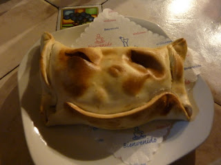
We were staying in the Barrio Brasil, the artsy (cheap) district, and on our first day we kept our explorations within that neighbourhood. Starving after the long flight, we grabbed empañadas for lunch – deliciously hot, although with surprise fillings including an olive and a slice of hard boiled egg. From there we ventured on to the newly-opened Human Rights Museum, which documents the period between Pinochet's coup in 1973 and his eventual defeat in 1990's first democratic elections in years. During this time, more than 3,200 people, including many children, were killed or disappeared and over 28,000 people were arrested, many of whom were tortured until they agreed to all manner of 'war crimes.' Over 1500 of these people are still missing, with no answers forthcoming as to their whereabouts. The floor to ceiling montage of their photos was very moving and served as a stark reminder of Chile's relatively recent dark past.

On a lighter note, the next day dawned bright and sunny and so we headed into the city centre proper to explore. As we wandered around the main squares, Plaza de Armas and Plaza de la Libertad, we were struck by how familiar and strangely European it felt: surrounded by ornate buildings and statues of figures on horseback, we could easily have been in Madrid, Paris or Rome. Except perhaps for the Chilean flags adorning EVERYTHING, ready for the Bicentennial celebrations of the founding of the country on the 18th September. This was a pretty big deal – 5 days of national holiday were planned to mark the occasion, and there was a really festive atmosphere in the capital in the days leading up to the big day.

It was too nice a day for museums, and so instead we headed for the parks, starting with Cerro Santa Lucía. Formerly both a convent and a military bastion, today it offers one of the best viewpoints of the city, the snow-capped peaks of the Andes rising majestically behind modern skyscrapers. It's an impressive sight, and it's only up here that we got a feel for how vast and sprawling the capital is. From there it was on to the Parque Metropolitano, the largest open space in the capital. Its highest point is Cerro San Cristóbal, reached via a very rickety cable car. At the top we were greeted with yet more stunning views, and also an enormous open-air church, complete with statue of the Virgin Mary and slightly creepy choral music played from hidden speakers in the trees. Apparently during the Spanish conquest, crosses were often placed on top of hills to show that the area had been 'won' for Christ against the infidels, so I guess this is the modern-day equivalent.

The following day was a little more overcast: perfect for museums! We initially had little success on this front – the first place we went to (the Palacio Cousiño, one of the grandest houses in Chile) was shut for refurbishment, and the second (the Palacio de la Moneda, the site of Pinochet's 1973 coup) was closed for Bicentennial celebrations. But it was 3rd time lucky with the Palacio de Bellas Artes (art musum to you and me). The incredible building was modelled on the Petit Palais in Paris, and was built to commemorate Chile's centenary in 1910. To celebrate the bicentenary, there was an exhibition featuring artists from 20 different countries ruminating on what Chile meant to them. A lot of it was crap. Better were the portraits of the improbably-named Bernardo O'Higgins, who is considered one of Chile's founding fathers. We also paid a visit to the Precolumbian Art Museum, a collection of artefacts from civilisations which predated the Incas. We were fascinated by the chinchorro, cadavers subjected to a form of mummification where the internal organs were removed and replaced with plant matter, before the skin was sewn back on. Nice.

But probably the best bit for us about Santiago was just wandering around, trying out our pigeon Spanish and getting used to being in a new continent after more than 2 months in the 'familiar' Antipodes. We discovered several cafés con piernas (literally: cafes with legs) where the female waitresses don short skirts in order to show off their assets to the largely male clientele. The cafes grew up as a reaction to both the strict dictatorship and the conservative religious norms here, but today they just look rather sweet and innocent, especially in comparison to the exponentially more filthy strip clubs which have sprung up more recently.

Auckland: The Anti-New Zealand?

Sunday, September 12, 2010 by James
Around 75% of the entire population of New Zealand lives in Auckland. Which is strange, as the city seems so unlike the rest of the country. The pace, for one, is about twice as fast as anywhere else in New Zealand, and it also seems that restaurants stay open after 8pm!

We stayed at a beach-side campsite in Takapuna, a suburb on the North Shore, from which we commuted into the city on the Devonport Ferry. Auckland has been called 'Sydney with training wheels' and you can easily understand why. Approaching the city on the ferry is a very similar experience to that of Sydney's Manly ferry, but despite Auckland's skyscrapers and the fairground appeal of the Sky Tower, the skyline is noticeably more downscale than its Aussie cousin. You could describe this as typical Kiwi understatement vs. brash Aussie showmanship, but to be honest I think we both missed the wow factor of Sydney's Opera-House / Harbour Bridge combo.

Our first day in town we took a walking tour of the city, from the ferry terminal in the CBD up through trendy Chancery District into Albert Park, which sits on a hill that would have looked out over the city had the skyscrapers not got in the way. We dropped by a redux version of the Auckland Art Museum (the main museum is currently being refurbed) and saw an interesting exhibition of 18th century Maori portraits by two famous artists of their day: Charles Goldie & Gottfried Lindauer. As misguided public opinion of the day was that the Maori were a 'dying race' the pictures tended to have a melancholy air very similar to the old portraits you see of Native Americans.

There are lots of building works in Auckland as the city prepares itself for next year's Rugby World Cup. As a part of this facelift the next stop on our tour, the civic centre, was fenced off and crawling with hard working hard hats. We circumvented the site and then trekked south up the hill through Myers Park to uber-trendy the St Kevin's Arcade, full of boutique fashion brands, vintage clothing and comic book stores. Flagging after the accumulated exertions of 3 weeks on the road, we then very gratefully retreated to an Odeon cinema to watch Scott Pilgrim vs. The World – Our last English cinema experience for who knows how long?

It was fun to be back in a city again, especially on a Friday afternoon with its boozy lunches and pre-weekend buzz, but at the same time our impression of Auckland was that some of the things we liked best about New Zealand – the laid-back pace, the always-friendly people, their lack of pretence and sense of humour – were somehow missing, ditched in the race to become a modern global city. Maybe I'm just more of a Southern Man...


The following day we woke up early to catch the ferry out to Rangitoto volcano. What a great name! Rangitoto is Maori for 'Bloody Sky', a description its last eruption 'only' 600 years ago. Whatever it means, it's definitely fun to chant in a tribal fashion a la Joe vs The Volcano. RAN-GI-TO-TO-RAN-GI-TO-TO. The whole of the Auckland region is pockmarked with active and dormant volcanoes, to which it owes its bumpy landscape. My GCSE geography allowed me to classify Rangitoto as a classic 'shield' volcano (thanks Mr McGrath) whose gentle sides were relatively easy to walk up. It started to rain as we got to the crater rim, but we still got a great view of the bay and the city in the distance.

We spent our final 24 hours in Auckland preparing for Phase 3 of our Grand Tour: South America. This involved washing all our clothes, eating one last meal of fish&chips, attempting to clean the van and conceal a dent I'd put in the rear bumper, and purchasing vast quantities of western medicine. We've been diligently listening to our Michel Thomas Introductory Spanish on the car stereo over the last 5 weeks, so here's hoping we'll be up to the challenges of a new language and a new continent!

Cape Reinga and the carpark at the end of the world

Thursday, September 9, 2010 by James
As we were already pretty far north and had some time to spare, we decided to fill the tank and make a mad dash up the Aupouri Peninsula to Cape Reinga – where the Tasman Sea meets the Pacific Ocean, and where Maori souls go when they die...

The Peninsula is around 100km long and 10-20km wide – a long spit pointing out from the mainland to the north-east. Its eastern coast has a few spectacular bays, mostly named by Mr Cook on his tour, and beyond the forests the western coast is lined by the unbroken sands of Ninety Mile Beach.

Most of the supposedly gorgeous scenery was hidden from us by heavy mists that floated in from the sea. As we drove further north the farmlands thinned to sheep-tended heath, and we left the mists behind as the road wound upwards towards the cliffs of the cape.

At the end of the Earth, there was a car park. We parked up. In the last ten minutes of our drive the temperature had suddenly dropped and more mist streamed across the clifftops from west to east. A suitably spooky setting for the entrance to the afterlife.

The Cape itself is marked by a lighthouse that watches over the merging of the Tasman and the Pacific like a referee. They don't play nice. Looking out over the water you can see slow giant whirlpools forming, white clashing waves and jagged zig zag tears where Sea and the Ocean meet.

Just to the east of the lighthouse is the most sacred site in Maoridom – an 800 year old pohutukawa tree growing out of a rocky outcrop. It is down through this tree's roots that Maori souls enter the afterlife. There were plenty of signs in the area asking us to refrain from eating, drinking or smoking whilst on the Cape out of respect for this sacred site. On the way back to the car park we met a group of young Maori guys who seemed pretty determined to flout as many of these rules as possible. Fags in one hand, Smirnoff Ice and Speight's in the other, they swaggered down the path towards the lighthouse in jeans and wife-beaters. One pointed out the tree to another with his beer; 'Yeah, so this is where our souls go when we die bro.'

On the way back down the coast we took a detour to get to the Ninety Mile Beach. It nearly proved to be a one way trip as the road gave way to muddy gravel, then sand. We parked the van before we got stuck, and walked out over the grassy dunes onto the beach. The sun was making a valiant effort to shine through the encroaching clouds, and the sand shone in the incoming tide.

After leaving the beach, we drove past a roadside stall selling Hangi in a Pie for $3.50.

'The Hellhole of the Pacific'

Wednesday, September 8, 2010 by James
...This was how Russell, the first European settlement in New Zealand was known in the 1800s. When Charles Darwin visited in 1835 he described its inhabitants as 'the refuse of society'. As a successful whaling & sealing town it was world renowned for its population of drunk sailors, escaped convicts and prostitutes. Disappointingly, when we visited it wasn't as nearly as much fun as billed.

It is in a nice spot though, and you can understand why those pesky outlanders dropped anchor here: Dead centre in an enormous protected bay dotted with a hundred little islands, lots of trees to cut down and mend ships, friendly/easily pacified natives, fresh water and easy hunting. Nowadays this haven is known as The Bay of Islands.

We were there to see dolphins. The calm waters are frequented by pods of common and bottle-nosed dolphins, whales and orcas. Having missed out on swimming with dolphins in Kaikora due to bad weather, we were hoping for a second chance. Unfortunately, we didn't see any bottle-nosed dolphins (who are happy to swim with people), but we were lucky enough to see a pod of about 100 common dolphins who were idly swimming around a mother and baby pair of Bryde's Whales. It was a fantastic sight. The dolphins looked almost lazy, slowly circling the boat, pfffing water from their blow-holes. The boat's captain told us that they would have just eaten, so were taking it easy to digest their food.

As well as dolphin-spotting our boat also made a stop at Urupukapuka Island, one of the biggest in the bay. We walked up to the top of the hill in the centre of the island to find stunning views of the rest of the bay, as well as the site of an old 'pa' – a walled Maori settlement. Reading about the European settlers and their exploits, it's easy to forget that the land they arrived in had already been inhabited for hundreds of years. This history is especially significant in The Bay of Islands area as the nearby town of Waitangi is where the British and Maori finally signed a treaty in 1840 that recognised Maori land ownership and gave them the same rights as British citizens in exchange for British sovereignty. (Aside: James Busby, the then British Resident who drafted the treaty was also the founder of viticulture in both New Zealand AND in Australia. Legend). The site of the treaty-signing in the seaside garden of the former British Residency, has life-sized replicas of the 20 foot war canoes that the Maori arrived in. How's that for an entrance?

Darkwater & Glow-worms

Monday, September 6, 2010 by James
Waking up to a rainy Rotorua, we rolled out of town and on through 3 hours of sheep-filled fields to the west coast to visit the Waitomo Caves.

Traditionally used as burial places for Maori chiefs, the limestone caves on the west coast had been mostly forgotten until recently when some avid cavers persuaded the land-owning farmers of their money-earning potential. Waitomo is the most famous of these accessible caves, its glow-worm covered cavities and fast flowing underground rivers making it the ideal location for some more kiwi adventure tourism. We chose the more tame Blackwater Tubing option, which we understood as gently floating down an underwater river seated on giant inner tubes, underneath a constellation of glow-worms. This was one element of the tour...

Our guide Brad was in his early twenties and sported a weird half-shaved / half-mullet haircut. As we got kitted up he regaled us with tales of his adventures with his caving-buddies, including one trip where they spent four days underground exploring a cave on the south island. Clearly a strange kid, he also seemed to suffer from a kiwi version of tourrettes, whereby he randomly punctuated his sentences with the word 'Sweet!', exclaimed at a high-pitch: 'Yep, just grab yourself a wetsuit there... Sweet! And get yourself a helmet SweetSweet! And we'll be getting down the caves SWEET!'

Of course it wouldn't be a kiwi activity if it didn't involve some kind of adrenaline rush. Blackwater Tubing delivers this by jumping backwards off underground waterfalls. Sarah did not look pleased when this part of the tour was explained to her. The jumping backwards thing is apparently risky enough to warrant a practice run. Dressed in wetsuits and crash helmets, and carrying our inner tubes, we waddled to a nearby stream where each of our group took turns to jump in, make a big splash, then paddle with the current to the side to climb out. When it came to Sarah's turn however, the cold water clearly induced some kind of shock, causing her to forget how to paddle completely. She was quickly taken by the current and carried downstream past the point where we were meant to climb out. Heroically, I dived back into the river to grab her just before she disappeared from sight, and towed her to safety. This act would have been more impressive had our young guide Brad not then shouted to me 'just put your feet down mate!', at which point I realised the 'river' was only four feet deep.

Anyway, with Sarah less than encouraged by her practice run, we drove to the caves access point and descended into the bowels of the earth. I really enjoyed it. At points we had to lie face down on our inner tubes and float under huge slabs of rock with only a foot of breathing space, and in others the caves opened out into huge caverns where we rode our tubes at pace down torrents of water. The waterfall jumps were awesome, and not nearly as cold as the trial run – after half an hour in cold water we couldn't really feel much colder. I think it's fair to say Sarah didn't like the experience as much, but Brad did a great job in guiding her down safely, and she has conceded that it was worth it in the end when we reached the glow-worm caves and switched off our head torches. By each grabbing the feet of the person behind us, our entire group was able to float down the underground river in a huge chain, everyone staring up at the luminous green lights that plastered the ceiling.

Rotorua. An angry land.

Sunday, September 5, 2010 by James
Driving into the outskirts of town we were greeted by the sight of steam rising into the darkening sky, seeping out from the earth itself. Scary stuff. We knew that there were geysers and hot springs and fueroles (where steam rises straight out of holes in the ground) in Rotorua, but we hadn't quite imagined just how many there were or how widespread they are. They're all over the place! The whole town is built on angry land. We drove through neigbourhoods where every house has a 6 foot pipe stuck into their front yard with billowing smoke coming out of it, and on our last night in town a bus driver pointed out where they had had a 'mini-eruption' 2 years ago by the side of the road in a small park. Surely it can't be sensible to hang around here?!

For some reason, instead of doing the obvious thing and getting as far away as possible, early Maori tribes saw the smoke, explosive water and bubbling mud and decided that this would be a nice place to settle down in, making Rotorua the spiritual centre of their culture. With this rich history to draw upon and ever increasing numbers of tourists to satisfy, Rotorua has become something of a 'Maori Disneyland'.

The worst of this was our trip to a 'Maori Cultural Performance'. I suppose we should have guessed from the name what it would be like. Started by an enterprising couple of guys called the Tamaki Brothers (who are apparently pretty gangsta according to the locals) in the 80s, the company drives tourists out to a reconstructed 'traditional Maori village' where Maori actors demonstrate the Haka and some other traditional rituals and entertainments before piling everyone into a large dining hall for a Hangi (earth oven cooked) buffet dinner. It felt like Butlins, and not in a good way. Sarah and I were less impressed by the performances than by the business. It cost around 100 NZD each, and in summer they can cater for up to 700 people a night, 7 days a week! Well done the Tamaki boys.

We breathed a sigh of relief when we boarded the bus home, only to discover that worse was yet to come. Our 'hilarious' bus driver forced all passengers to sing, by nationality, on the ride home (Sarah and I belted out a passable Welsh National Anthem having not been able to come up with a 'typical English song' Aside: What would you say is a typical English song? Aside from that dirge of a National Anthem? Answers on a postcard...) and when someone refused – a pair of petrified young Japanese women – the bus was driven around and around a roundabout, six times, until someone helped them out. Oh what fun we had...

Our best Maori experience was a visit to the hot springs to see the geysers Pohutu and The Prince of Wales' Feathers (thus named when the man himself visited and claimed that water spraying from the geyser looked like his heraldic badge). As well as telling us a bit about the history of the hot springs, our guide Mel was a font of information about the early Maori settlers – from how they made warm clothes from plants (as there were no cattle or sheep in New Zealand when they arrived), to the symbolic significance of the various buildings in a traditional settlement. I was interested to find out that for the first few hundred years after they arrived from Polynesia the Maori were a very peaceful people. That was until they had hunted all the easy prey to extinction and had to start fighting for land to farm.

Rotorua has been a tourist mecca for over a hundred years. The biggest leftover from the Grand Tours of our predecessors is the Victorian Bath House, where well-off foreigners used to come to 'take the waters'. By all accounts the Baths were awful, even by Victorian standards. Not only is the water so corrosive that the place had to be shutdown one week after opening to clean all the pipes – the first of many maintenance issues – but the treatments they devised were absolutely horrific. Our fave was the 'electrified bath' which involved the strategic application of direct currents to people's baths. Apparently good for treating those with a nervous disposition.

Nowadays the building serves as the town's museum. As well as seeing some of the original bathing equipment, we also saw a great exhibition about the All-Maori B Battalion's exploits during WW2, as well as an awesome video about the volcanic eruption of 1918 which featured a young Bret from Flight of the Conchords as a British tourist who gets killed when his house collapses.

Napier and Taupo

Saturday, September 4, 2010 by Sarah
Napier is famous amongst architectural students as its architecture is almost entirely Art Deco in style. Similar to Innisfail in Australia, an earthquake occurred here in 1931 and demolished most of Napier's brick buildings, all of which were then rebuilt according to the fashion of the day. But not just because it was fashionable (so James tells me) – it was also the cheapest and the safest means of building known at the time. We did a little walking tour around the centre, admiring some of the more outrageous buildings, including St John's Cathedral and the Telegraph newspaper. Overall I think I actually preferred Innisfail – though smaller, it felt like more was being done to preserve the style of the place, even with the more modern buildings being constructed. Napier felt altogether more of a living, breathing, working city. That said, it being a sunny Saturday morning, it seemed like a lovely place to grab brunch with friends, and we passed many people doing just that.

The earthquake in Napier turned New Zealand into one of the foremost earthquake research centres in the world – a lot of the lessons learned from the 1931 earthquake have been adopted worldwide, and also have been used in the construction of new buildings throughout the country too. Sitting as it does on the 'Pacific Ring of Fire,' the precautions seem sensible. It was actually whilst we were in Napier that we found out about the earthquake in Christchurch.

From there we drove on to Taupo (pronounced Toe Paw, apparently!) which is home to a very big lake – the biggest lake in New Zealand in fact. It's a beautiful lake, and we intended to spend a happy half hour at the lakeside – until I got scared away by the ducks.

Instead we opted for a nice safe coffee in a cafe.

Taupo is being promoted as the adrenalin-junkie capital of the North Island, but having already done our skydive, and not really fancying the jet boating, bungee jumping or white-water rafting, we didn't stick around long. It seemed like a pleasant place to while away a couple of days, if you had a little longer to see the country than we do.

On the way out we did make a stop at Hukka Falls which were awesome – 220,000 litres of water a second gushes out of a narrow channel, enough to fill 5 Olympic sized swimming pools every minute. Was pretty awesome to see the power of the water in action, and I think we got a little overexcited, as we spent the next 20 minutes singing along to Ellie Goulding in west country accents.