Showing posts with label australia. Show all posts

In awe at Uluru

Thursday, August 19, 2010 by James
On our early morning Jetstar flight from Cairns to Ayer's Rock, there were only 10 passengers on the 120 seat plane. This meant that as we cruised down through the clouds over the Red Centre, we could all have left hand window seats and watch Uluru come into view.

What a sight. Flat bush scrub almost as far as you can see, then bursting out from this landscape the sandstone monolith of Uluru. It was a sunny, windy morning of fast moving clouds, which caused patches of sunlight to race along the desert floor and flow up over the rock. As we passed Uluru and descended to Yulara airport, it looked like these patches of light were standing still and that the rock itself was moving – a giant stone whale swimming through a calm red sea.

Yulara is a town that was built in the 70s to service the tourists visiting Uluru and Kata Tjuta. It's a small place built around a ring road that serves 6 different over-priced hotels, a couple of over-priced restaurants, an over-priced supermarket, and some over-priced tourist-tat shops. As you're in the middle of the desert, 100km from the dead centre of the continent and 5 hours drive from the nearest town, you're really in no position to complain about the prices. Besides, as soon as you see Uluru all cause for complaint is forgotten. It's simply breathtaking.

Having only seen it in postcards, the big surprise for me was how un-uniform the rock is. Every angle different, and every angle different depending on the time of day, light and weather you view it in. You could literally stay there a year and it would never look the same twice. Of course, we could barely afford to stay in Yulara a day, so I think a year's stay is unlikely. This variation gives the rock a degree of personality that goes a long way to explaining its iconic status. Of course it's hard not to develop a personality once you've been around, in the same spot, for around 365 million years. To put it in perspective, Uluru was there, Lording it over the desert, when the Himalayas were but a twinkle in the eye of the Indian continental plate.

Uluru is a 15 minute drive from Yulara. Strange given its size, but you don't see it immediately. Then, all of a sudden, you round a bend in the road and there it is. Soaring above the sand, dust and scrubland, with an other-worldliness that is totally captivating. I'm sure there is a scientific way to describe the eery vibrations of the place – magnetic currents or air pressure changes or something – but whatever the cause, walking around and craning your neck to stare up at the rock face, you can completely understand the spiritual importance that the Aboriginal tribespeople attach to it.

After getting our first tantalising glimpse of Uluru as we landed, we didn't actually get up close and personal until the end of our first day. Instead we took a tour bus to see the other attraction in the area – Kata Tjuta or 'The Olgas'. These rock formations came about through the same series of geological processes as Uluru, except with a different type of rock – a composite sandstone known as 'Pudding stone' rather than pure Arkose sandstone. Instead of one large rock, Kata Tjuta is a range of rocks, huddled together like giants with their backs to the desert. We walked into the huddle through the aptly named Valley of the Wind. Air moving uninterrupted across the desert is compressed as it comes up against the massive rock faces, creating a gale that tears around the base of the formation. Again, imagining a tribesperson tentatively approaching these strange rocks from the searing flat heat of the desert only to have an unimaginable wind appear from nowhere, you can empathise with the mythic status of the area. Kata Tjuta is actually so sacred to Aboriginal culture that their stories relating to its origins can't be shared with outsiders.

Tired from our trek through Kata Tjuta, we drove back to Yulara via Uluru to watch it as the sun went down. As our shadows lengthened the sandstone face of the rock blushed from ochre to orange to a deep red before the colour left it and night fell. It was pretty magical to watch. Every person climbing back onto the minibus had big grins on their faces.

We were back there the next morning, holding mugs of tea as the sun rose. It was another cloudy day, so the sun, when it came, slowly painted Uluru in pastels. Much less dramatic than sunset but no less beautiful, from our viewpoint we could also see Kata Tjuta in the misty distance.

After watching the sun rise, we joined a small group to go on a bush walk led by a woman called Judy – an Aboriginal person from the indigenous tribe – and a translator called John. It was a fascinating experience.

In the states we had visited thus far, the Aboriginal population was largely invisible. Sadly, the only Aboriginal people we saw in Queensland were a few knocked-about looking drunks; sitting in groups on street corners in Kuranda and Atherton. From our limited understanding of a very complex situation, it seems that the Aboriginal people haven't yet recovered from a combination of the treatment they received at the hands of European settlers, ongoing discrimination and a monstrous social policy from the 20s up until the 60s whereby all Aboriginal children were relocated away from their supposedly 'irresponsible' parents. The legacy of this Lost Generation is still felt in much higher levels of alcohol abuse, domestic violence and a lower life expectancy amongst Aboriginal people compared to the country's average.

Judy was a weathered-looking middle-aged woman, with matted hair and slightly dirty clothes. She depended on John, a slightly nerdy guy in his early 30s (he reminded me of the music geek that works with John Cusack in High Fidelity) to translate her dialect, but she clearly understood quite a lot of English and threw in explanatory words here and there. She was a little shy with us, but was at pains to make sure we got our money's worth from the tour, and even allowed people to take photos of her working which is traditionally forbidden in Aboriginal culture. She was also very particular about the tasks she was carrying out – even scolding John when he didn't carry out her instructions correctly. At the end of the tour she asked for business cards with the Aboriginal Centre's email address to be handed out, so that we might send her copies of the pictures we had taken of her.

The bush walk took us from the Aboriginal Centre to the base of Uluru. On the way Judy taught us how to make 'kitty' – a resin used to glue together or repair tools – from the bark dust of the Minura tree, and pointed out the various trees and plants that are or were important to her tribes-people's way of life: the bark of the Bloodwood tree was used to make their bowls, the Mulga tree to make their spears, and Corkwood flowers to sweeten their water. Men and women have separate and specific roles in traditional culture, so the group split in two for the men to have a go at spear throwing and women at carrying the bowls and mats on their heads.

End of the road... Cairns

Tuesday, August 17, 2010 by Sarah
And so, after two and a half weeks on the road, we reached our final destination. Cairns is the biggest town in northern Queensland, and prides itself on being a hub for visiting tourists. It certainly is making the most of its reputation – every second shop is a travel agent selling trips to the Reef and / or to Cape Tribulation – but once you get beyond the main streets overlooking the sea, it quickly becomes as small-town industrial as Rockhampton or Mackay.

The main purpose of a visit to Cairns is a Great Barrier Reef tour, and having already accomplished this, we were in for a relaxing couple of days. The weather was glorious and after the break-neck pace of the last couple of weeks, we didn't think we'd have too much difficulty with doing nothing for a while. We spent our first morning on Trinity Beach, one of Cairns's famous northern beaches, enjoying a cuppa and the sunshine from our camp chairs. What a way to spend a Monday morning!

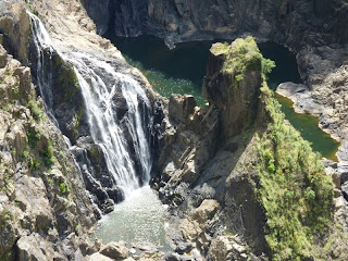
En route into the city, we visited Kuranda, a self-confessed 'tourist town' which was originally established in the 1960s by a gang of hippies wanting to make a bit of cash. Today it lures the crowds with its 'traditional markets' selling all things tie-dyed and hand-woven. Apparently the best bit is actually getting there from Cairns: either by train through Barren Falls National Park, or by the Skytrain (a cable car to you and me). Since we drove, our overall impression was less than favourable. We had a half-hearted wander around the markets but quickly lost interest. The National Park was better: the elevated walkway gave stunning views over the local rainforest, culminating in a spectacular vista of the Falls far below. We also very much enjoyed stalking a couple in matching lime green T-shirts and jeans (check out the sneaky photo). If only we could take them with us to New Zealand, we might not look so conspicuous in our matching jackets.....

Cairns' most famous 'sight' is the Esplanade, or Boardwalk, as the Americans would call it. This walk runs alongside the ocean (there is no beach in Cairns) and gives close access to the pelicans who come to feed there at low tide. The Esplanade is also home to the Lagoon (lido to the Brits amongst you) where we spent as much time as possible during our two days in the city. It was absolutely packed every time we walked past, and no wonder – the council provides the lagoon completely free of charge to all who want to use it, complete with BBQs and aqua classes. In the UK, this place would be covered in graffiti and used as a toilet by tramps, but here, everyone seems to take much better care of their amenities. It's the hub of the city, even in 'winter' – though obviously in the tropics, 'winter' means 31 degrees rather than 41 degrees, and so the weather doesn't really prevent the swimming and sunbathing!

As I rounded the reef, the divemaster turned back to me, put his hand to his head like a fin and pointed to our left: 'Shark!'...

Sunday, August 15, 2010 by James
...He then made the 'Awesome' sign. Yeah, I thought. Awesome. About twenty feet away, the pale, terrifying, instantly-recognisable shape of a shark cut through the water in a slow curve, around us and away. It was a 6 foot long, whitetip reef shark.

We spent the day diving on the Opal Reef – a popular spot on the outer fringes of the Great Barrier Reef - having caught a high-speed catamaran out from Port Douglas with a company called HABA. Diving in Australia is big business. In Thailand on Koh Tao, our boat was twenty feet long, had 4 instructors and 8 divers. HABA's cat was about 60 feet long, had 25 divers, 75 snorkellers and 3 instructors. And a buffet lunch.

We were on a strict timetable, so after the hour and a half commute out to the first dive spot (during which we spotted another humpback whale) we were suited up, striding in, and descending to 18 metres before we really knew what was going on. This haste was probably a bit too much for Sarah and me. My oxygen consumption was awful, and Sarah had to abandon her dive after 15 minutes as her ears couldn't equalise quickly enough. HABA were kind enough to give her an extra dive for free later that day though. Sarah was (and still is) very pleased with this, as it means she now has one more dive in her log-book than me, so is technically a more experienced diver. Whatever. Has she seen a shark yet? No.

Once we got down there, the dive was great. The variety and number of fish around us was incredible. We swam around towers of coral and over giant clams, through shoals of chevron barracuda and (my favourite) yellow-tailed fusiliers, and even spotted a few clown-anenome fish (a Nemo for Alex & Rex). I was told by some of the more experienced divers that the reef wasn't in that great a condition compared to Thailand or the Red Sea, but it's hard to take these kinds of comments seriously when you've just swum with a shoal of barracuda or rapidly away from a shark!

Nearly there...

Saturday, August 14, 2010 by James
Cape Tribulation is the northern-most point of our Aussie road trip, roughly 3000km from where we started in Byron. It was named by the famous Captain (then Lieutenant) Cook, who, having sailed nearly 16,000 miles across the world, managed to crash into the Cape 200 feet from the beach in 1770. Luckily a clever crew member managed to patch the ship's hull with an old sail, enabling them to coast ashore into a palm-lined paradise...

Before we visited this paradise, we visited the namesake town of the Daintree National Park, Daintree. The park is pretty impressive. The LP (Lonely Planet) tells us that although it only covers 0.01% of Australia's landmass, it has 36% of the country's mammal species, 50% of all birds, 60% of all butterflies and 65% of all ferns! Impressive as the park is, the village itself wasn't much. It featured three arts and crafts stores, a fish and chip shop and a sleeping dog.

Daintree village sits on the bank of the muddy Daintree river, surrounded by mangrove wetlands. If you ever go to Daintree, the one thing you should remember is DO NOT GO ANYWHERE NEAR THE WATER. There are around 70 adult estuarine crocodiles cruising around in its murky waters. We had already been suitably freaked out by one of these creatures in the Bornean rainforest, so what did we decide to do in Daintree? We hopped onto a shallow bottom boat and went looking for some more...

At Bob Belcher's Crocodile Cruises (awesome name! Like a villain out of a Roald Dahl book), the receptionist shuddered when I bought an ice-cream from her;
'How can you eat that? It's so cold!'
It was 25 degrees. But to be fair to her, that's 10 degrees less than it normally is at this time of year. Luckily for us, the chilly temperature meant it was a great day to be looking for crocs. When it's hot they normally sleep / lurk under the water amongst the roots of the mangrove trees.

Coasting down the river bank at noon, swerving round thick overhanging tree branches and up side-streams, we saw 3 adult crocodiles. The first was Elizabeth, a 20 year old female thus named because when she was younger she had a paw injury that made it look like she was giving a royal wave. As we chugged by, Elizabeth decided to join us, and coasted alongside us for ten minutes, slowly swishing her tail, blinking her 2 sets of eyelids against the midday sun.

Having thankfully left Elizabeth behind us we then spotted Scooter, a 20 year old male lying on the river bank warming himself in the sun; and last but in no way least we saw the 46 year old, 5.3 metre long big daddy of the river, Fat Albert. He was mostly underwater with just his massive head resting on the bank, but you could tell from the shadow of his submerged body just how enormous he was. Though they look slothful for most of the time, when they want to crocodiles can move at 60kph – both underwater or on land – from a standing start. Imagine a 5.3 metre, 1 tonne crocodile moving at you at that pace.

(NB. Googling 'Fat Albert' just now to check I got his size right, I came across a news article from November 2009 in which crocodile tour operators were facing a government investigation after Albert attacked one of the tour boats: 'In an unprecedented attack and with little warning, the dominant 5m male known as Fat Albert, lunged nearly a metre out of the water and bit the railing of a small tour boat. Tourists scattered for safety as the huge crocodile left behind bite marks in the metal'. Very glad we didn't read this beforehand!)

Still shivering with fear, we drove on from Daintree and boarded the car ferry to cross the crocodile-infested river and get onto the Cape. It's like Jurassic park over there. Enormous trees, giant ferns and steaming mountains looming over the forest. The beach Cookie (our nickname for the increasingly familiar Captain Cook) landed on was incredible. Aside from the crashing incident (and later being killed by natives) he was a lucky man – white sands, turquoise waters and palm trees.

As we took another trek through tropical rainforest on the Cape, alert for rogue Cassowaries, it was amazing to think that 6 weeks earlier we were in the snowy mountains of Tasmania, and that just a week ago we were in the cool farmland of the Atherton Highlands. Even having driven 3000km across just one state, the sheer scale of Australia is hard to get your head round.

The Atherton Tablelands

Thursday, August 12, 2010 by Sarah
We were told by our friendly travel agent in Byron that if we were going to Cape Tribulation we simply must go the long way round and see the Tablelands, and I am very glad that we did. The 'Atherton Tablelands' is the collective name given to an area inland from the coast, which is home to some of the most beautiful scenery and natural features we've seen in Australia thus far. As James described it, “it's like the English countryside on steroids: everything's bigger and greener.” The site of Australia's most recently active volcano (which last erupted some 10,000 years ago), the geography here is quite different to most of what we've seen in recent weeks, and it was a pleasant change not to be surrounded by sugar cane fields!

As a result of the volcano, the Tablelands boast a spectacular array of mountains, waterfalls and crater lakes – every 5 miles or so there's another brown tourist sign (they're the same as in the UK) inviting you to turn off and admire another natural feature. We were quite spoiled in the two days we spent there. We started with the 'Falls Circuit' near Millaa Millaa, on a whistle-stop tour of 3 sets of waterfalls, each more impressive than the last. You can actually go swimming in the pool at the bottom of Millaa Millaa, the biggest of the 3, but as the sun was setting as we reached it, we decided to give it a miss. Instead we opted for a dip the following morning in Lake Eacham, part of the Crater Lakes National Park. It was pretty chilly, but the brevity of our swim was more the result of an irrational fear about there being crocodiles in the water, when in fact the most dangerous animal we actually saw was a baby turtle.

We visited a 500 year old fig tree, known locally as the Curtain Fig (because it vaguely resembles a curtain). Figs have a nasty habit of latching on to the trees around them and gradually killing them off (hence the name, Strangler Figs) but the results are pretty spectacular – long tendrils of branch snaking in every direction.

Best of all the natural features we saw was Mossman Gorge, even though I thought a gorge was a mountain, and so was expecting to see something completely different! The Mossman River tumbles its way over and around huge granite boulders that line the gorge, creating freshwater swimming holes. It's a great place for sunbathing and swimming.

As well as the plethora of natural features, there are also a number of villages in the area. Some of them are barely more than a couple of houses either side of a single street, but others have a bit more to them. Atherton, the 'capital' of the Tablelands, is home to the Crystal Caves, an underground cavern showcasing the mineral collection of a Frenchman and his family, featuring crystals from all over the world. We didn't actually visit owing to the exorbitant entrance fee, but I imagine it would be a pretty surreal experience, featuring as it does the 'Magic Spheres' exhibition (“NEW for 2010, the Magic Spheres presents rare minerals in a totally new and mesmerising way”). Instead, we did do the tourist thing in Mareeba, the most commercial of the Tablelands' centres [and the closest to Cairns – no coincidence there] visiting both a coffee factory / museum (“the only one of its kind in the world!”) and a mango wine producer. We weren't too impressed with either – the mango winery was charging $5 for every taste which didn't result in a purchase, so I can't tell you what it's like – but the free chocolate samples at Coffee World were pretty good. Much more enjoyable was the Mungalli Creek Dairy, a biodynamic cheese and yoghurt producer. I still don't know what biodynamic production actually is but their chai yoghurt with honey was delicious – and has since been very good with muesli of a morning.

Small Towns of Queensland

Wednesday, August 11, 2010 by Sarah
Queensland north of Bundaberg seems a lot like the American mid-West – filled with small towns, all built on a grid system, populated with squat purpose-built buildings. It feels like you've been transported back in time to the mid-1950s.

This is definitely the working part of the state. As we learned in Bundaberg, the dominant industry is sugar cane, and we drove past more fields of sugar cane all the way up the coast. Sugar cane trains regularly sped by along the railroads, as it's currently crop harvesting time over here. A visit to the Sugar Industry Museum (no really, it was fascinating) taught us that Australia is the second biggest global exporter of sugar, second only to Brazil. Although mechanisation has gone some way to modernise the industry, it still seems pretty traditional – much like the towns the workers live and drink (Bundy) in.

After a while, all these towns started to merge together a bit, but here are a few of our highlights:

Gympie (seriously) is a former gold-rush town, which reached its peak in the mid-19th century as the first gold mining town in Queensland. Today it is home to such gems as the 'Hair Force One' hairdressers and 'A Man's Toybox' – which is a tractor store, before anyone gets any other ideas.

Maryborough was actually the hometown of PL Travers, who wrote Mary Poppins. This appears to be its sole note-worthy feature; aside from this, it's just another quaint market town.

Rockhampton, or 'Rockie' as it's affectionately known to locals, prides itself on being the Beef Capital of Australia. There are apparently, some 2M cows within 250km of the town, and to celebrate this fact, the powers that be have commissioned...wait for it....6 life-size plastic cows around the town's main streets. It didn't exactly match up to Bath's pigs back in the UK, but we did amuse ourselves for some, oh, 10 minutes trying to find them all.

We learned that boozy Mackay is considering closing its main street of a weeknight in order to dissuade drunken teens from hanging around and making a nuisance of themselves. Considering how little there is to do there, it's hardly surprising that they are turning to alcohol – we were just amazed it wasn't anything stronger. It does have a nice beach though.

Bowen amused us with its 'Bowenwood' sign up on the hill as you drive into the town. Someone on the council clearly has a sense of humour.

Townsville. What is the point of Townsville? Seriously? Allegedly the 'second biggest town in northern Queensland,' we struggled to find its centre. Were it not for the free internet in the library we would've struggled to fill half an hour. But perhaps I'm just being unkind, and there's a thriving....something....going on there somewhere that we just missed.

Much more to my liking was Innisfail, a town from the 1920s. When most of the (timber) buildings were destroyed in a cyclone in 1918, the people decided to rebuild in stone, in keeping with the fashion of the day. As a result, the whole place is constructed in an art deco style – lots of rounded edges, portholes and sunbeams. In order to keep things consistent, all new buildings have to be designed in the same way, and so the effect is like being on a film set. James was less than impressed and stayed in the car, but I insisted on doing the walking tour of the main street, to fully appreciate the place.

Much more exciting than most of the towns (Innisfail excepted) were the giant objects which Australia has erected as random 'tourist attractions' in this part of the world. We first read about them in Bill Bryson's 'Down Under' and had I not now seen a few with my own eyes, I wouldn't have believed they existed. The giant objects tend to be something which locals believe sums up the character of their village or town. So far we've seen a giant mango and a wellington boot, to commemorate 'the wettest town in Queensland.' Tully received some 7.9m of rain in 1950, thus beating out Innisfail and Babington to the title. The giant boot is exactly 7.9m tall, and you can climb an internal spiral staircase to reach the top and get great views....of the sugar cane factory opposite. Apparently there is a giant lobster and also a giant koala somewhere around here too. I live in hope of seeing them before we leave.

Cruising the Whitsundays

Tuesday, August 10, 2010 by Sarah
We were lucky enough to spend two incredible days sailing around the Whitsunday Islands in a racing yacht called the Iceberg. For the sailing enthusiasts amongst you (Tom) it was a 52 foot fractionally rigged sloop, originally built for the 1992 Sydney to Hobart Boat Race, which it competed in for four consecutive years. Neither of us had ever been on a proper sailing boat before and so we were pretty excited.

We were a little nervous initially as the weather was not great: overcast with a changeable wind, which made the sea pretty choppy. On the first morning we motored out through the waves with our sails down. Everyone was starting to feel a little bit seasick, and so our first lunch was a fairly quiet affair. However, the weather gods were smiling upon as, as the skies cleared up and the sun came out in the early afternoon. And so we saw the Whitsundays in their absolute best conditions – blue azure seas and clear skies during the day, starry skies at night.

The Whitsundays are made up of some 60 islands off the coast of Airlie Beach. Almost all of them are partially or completely designated as national park, and only a handful are actually open to the public at all. As a small boat (just 12 passengers on board), we had close access to some of the islands' highlights, which most bigger boats are not allowed near. The most famous of these is Whitehaven Beach, a 6km stretch of white sands and blue seas – we were the only people on the beach, with the exception of the owners of a helicopter which landed moments before us. Alright for some.

There was also time for a 'bonus beach' on our second morning. The Langford Sand Spit is a stretch of sand between Hayman and Hook Islands which only appears at low tide. This was a natural paradise, with turtles and stingray swimming in the shallows. Our trip here followed a morning of impromptu whale watching from the boat – July to October is whaling season, when pregnant humpbacks come inland to give birth. We saw about 8 or 9 whales in fairly close proximity, including one who, showing off, spent a good 10 mins with her fin in the air. It was an amazing sight.

But the absolute highlight had to be the snorkelling. We had two snorkel stops in all, both on the fringes of the Great Barrier Reef. The best of these was a stop just off Blue Pearl Beach on Whitsunday Island. The water was crystal clear and so we saw shoals and shoals of colourful fish, including yellow-tailed fusiliers, sergeant fish and parrotfish. But most impressive was the enormous Napoleon Reef Wrasse, a fish bigger than me which was happily swimming among us. It's left us feeling incredibly excited about our upcoming diving trip further north.

A few words on language

Sunday, August 8, 2010 by James
'Two countries separated by a common language' applies just as well to Antipodeans as it does to Americans. It seems they insist on abbreviating everything to the shortest, most casual form possible.

The classic examples (gleaned from years of Neighbours watching) are:

Afternoon → Arvo
Chicken → Chook

But how about...

Breakfast → Brekkie
Strawberries → Strawbs
Pedestrians → Peds
McDonalds → Maccers
Vegetarian → Vego
A Politician → A Pollie!

I'm not even sure if these can be called slang either, as they're used by absolutely everyone, regardless of how formal the occasion. Having been in Australia for the build up to the recent general election, we tuned in to watch the first of the televised debates when we were in the Blue Mountains. The leader of the opposition Tony Abbott began his opening statement, 'I want to give the Australian people a fair go.' A Fair Go!!! This is apparently his key campaign message! He then went on to use the phrase 'Fair dinkum' twice in the first five minutes before we turned the TV off.

A variation on pure abbreviation, there's also a fair amount of very literal slang in Australia. My favourite is the name they give fruit machines over here: 'Pokies.' I was buying some beer in a 'bottle-shop' and asked the shop keeper if they were screw caps or not: 'Twisties? Yeah I reckon.'

P.S. One last bit of slang worth mentioning purely for its crudity. Apologies, but - Shit-arse. As in 'Are you working this weekend?' 'Yeah... Shit-arse.'
Posted in Labels: , , | 0 Comments »

Bundy & Coke

by James
A Bogan = An Australian cross between a redneck and a chav

Bundy = Bundaberg Rum, Bogan drink of choice

Much of the north of Queensland is given over to sugar cane farming. The industry has been going strong ever since the 1770s when cane was brought over by the First Fleet. The plant was supremely suited to the rich coastal soil and sunshine of the north – Highway 1 cuts through miles and miles of sugar cane farms on the way north to Cape Tribulation.

Where there is sugar, there is rum. Having discovered the spirit during their West Indian endeavours, rum became the drink of choice for British colonialists in the 18th century. Rum was therefore very much a part of life in 'New Holland', especially for the convicts and navy types who made up most of the original settlers. Taxes from rum sales built most of Lachlan Macquarie's famous civic buildings that we saw in Sydney.

With this vibrant market in mind, in 1885 Mr Frederick W. Buss proposed to a group of local sugar millers that they club together and build a rum distillery to generate some extra cash from the otherwise wasted mollasses – a by-product of their refining. Despite burning to ground twice within the space of 50 years, the distillery was a great success and still exists on the same site, next to the Millaquin Mill on the outskirts of the town of Bundaberg.

Having heard a bit about the rum brand from our friend Kate, both Sarah and I were looking forward to visiting the distillery on our road trip up the coast.

The distillery is as straight-up and no-nonsense as the brand. No smoke & mirrors here. Rolling up the dirt track to the front gates we the raw chopped cane shunted past us in dusty cane trains. On the tour we were taken into the working distillery and saw the Olympic swimming pool-sized vats where they store molasses, their column and pot-stills, the bonded warehouse where they age their rum in giant 60,000l barrels and the small bottling line where they package their main brands.

There was also an interesting museum section which displayed historical advertising for the brand. Bundy's big breakthrough came in the mid 80s when the marketing manager introduced a new logo and label for the rum that, inexplicably, featured a polar bear. The bear has since become so iconic that no-one seems to ask why he was chosen as the front-man for an Australian rum made in sub-tropical Queensland...

Sarah and I both enjoyed tasting the finished result in the Bundy bar. We found Bundy Original to be pretty rough straight up (bloody soft Poms!), and much preferred the new Bundy 'Red' which is filtered and has some added vanilla for smoothness. We bought a couple of tinnies for the road and after a break for lunch to let the buzz die down to legal levels, we drove off into the sunset.

Noosa

Saturday, August 7, 2010 by Sarah
Like the Gold and Sunshine coasts, Noosa appears to be something of a retirement community, albeit an incredibly premium one. If the Sunshine Coast is like Florida, then Noosa would be the Florida Keys. It also appears to be a popular holiday destination, judging by the numbers of people we saw enjoying week-long breaks. Filled with gourmet restaurants and boutique clothing stores, we could definitely understand why.

We only had time for an overnight stop before it was time to head on up the coast, but we made the most of it by booking in for another surf lesson. On recommendation, we'd booked with Merrick's Surf School – Merrick being an ex-Aussie champion surfer, who now runs a surf school from the back of a van in a car park. We were a little concerned, especially with 5 of us in the class, and a slightly delayed start, that our second lesson wouldn't match up to the first. However, there was no need to fear – if anything, this lesson was even better. Our instructor was a laid-back surfer dude from Newquay called Tim, and although we were given a little bit more free reign to catch our own waves, he gave us great feedback about how to improve after each ride.

I also discovered my surfing skills weren't in fact a fluke, but that I am actually a fairly competent novice surfer. As well as standing up to catch a few waves, I even managed a pretty impressive-looking 'backside run along a long right-hander' (or so I'm told), which prompted compliments not only from a couple of silver-haired female boogie boarders, but also from James, who I think was a little bit jealous. A surfing holiday could definitely be on the cards in the near future.......

Gold Coast, Sunshine Coast.....

Friday, August 6, 2010 by James
The Gold Coast is the name of the stretch of coastline beginning at Coolangatta, running up to Surfer's Paradise. Past Brisbane it morphs into The Sunshine Coast, which ends around Noosa before becoming the Fraser Coast (around Fraser Island) then The Capricorn Coast (around the Tropic of Capricorn). I thought these were all just nicknames, not real places with street signs and logos and everything. 'Welcome to Surfer's Paradise - a part of The Gold Coast'.

Regardless of which part of the Queensland coast you are officially on, the coastline itself is stunning. After leaving Tweed Heads we drove north from Coolangatta as close to The Gold Coast as we could, 50km of endless sunny beaches, increasingly expensive beachfront properties and world class waves. Unsurpringly, we heard that this is Kelly Slater's favourite patch of sea.

Surfer's Paradise (named by a clever hotelier who lobbied to for a name change from the less marketable 'Elston' in the 1930s) was a strange place. We've heard it compared to Miami, but in my opinion this does great disservice to my friend Shan's hometown. Surfer's has none of Miami's slick and sexy glamour - it felt more like a town on the Costa del Sol. Aside from its near perfect beach and abundance of strip clubs, we found no reason to be there. We stopped in for a coffee and some internet time in Maccers (McDonalds – the only place in Oz with free Wifi and cheap coffee), just in time to see a junkie evicted from one of the booths by the police.

From Surfer's we headed inland and skirted around Brisbane to Mooloolaba and the start of the The Sunshine Coast. Everything changed. The coast was just as incredible, but suddenly the comparisons to Florida made sense. Palm trees, strip malls and 2 lane highways everywhere, drive-through McDonalds and the average age jumped to around 65. East Coast Americans retire to Florida, East Coast Aussies to The Sunshine Coast.

I hoped Noosa would be nicer...

The Griffiths Family, Down Under

Thursday, August 5, 2010 by James
In the 70s my grandpa's brother Jack Griffiths emigrated from Wales to Australia with his wife Enid and their kids Pam and Lynn. The family flourished, and there are now two more generations living in the area of Tweed Heads.

(They weren't the only Griffithses to move down under. Over the last couple of weeks I've been shocked by the number of Griffiths Streets, shops and even islands dotted around!)

Tweed Heads is all of 40 minutes drive from Byron Bay, so our first morning in the surfer town I rang Aunt Enid out of the blue and at very short notice we arranged that Sarah and I would pop around to say hello the following day.

We spent the intervening night testing the limits of our campervan by sleeping in a motorway lay-by – a trick not to be repeated – so were most receptive to the spoiling we received at Aunt Enid's the next day. Despite having celebrated her 90th birthday earlier this year (by travelling 200km into the outback in a campervan), she had clearly been slaving away in the kitchen all morning. Soon after we arrived we were having high tea complete with chocolate cake, Victoria sponge, an apple tart and last but definitely not least...Welsh cakes!

Everyone was there to meet us. Pam, Lynn, Pam's daughter Elizabeth, her husband Mike and their baby boy Charlie. Lynn regaled us with stories of going to Sully Primary School with my mum as we sat out on the balcony and watched trawlers and dolphins in the river below.

After tea we took a drive into town to see the state border and what was one of Uncle Jack's favourite walks. Half of the town is in New South Wales – the part called Tweed Heads – and the other half is in Queensland – Coolangatta. We parked up next to the border and walked around the 'head' itself, criss-crossing between states. Below us crowds of bobbing surfers in the bay, and in the distance to the north the high-rises of Surfer's Paradise floated like a mirage.

Not having really understood the scale of Australia, we were planning on driving on from Tweed Heads to Noosa that evening. On sharing our plan we were met with sceptical looks, and it was explained to us that Noosa is a good five hour drive away. With very little persuasion, we agreed to stay the night at Mike and Elizabeth's house and tackle the drive in the morning. We had a wonderful evening being entertained by Mike, Elizabeth and Charlie. We traded travelling stories with Mike and Liz and they told us all about their time in the UK, and Charlie presented us with various of his favourite toys and also showed us his brand new racing car bed. Pam then brought by a 'back up' casserole she had prepared and we went to bed in a luxurious double bed in the guestroom glowing with the warmth of their hospitality (and wine).

Thanks again guys for having us!

Surf's up!

Wednesday, August 4, 2010 by James
Byron Bay was the southern-most point of our 2 1/2 week Aussie Road Trip. Over the next couple of weeks we plan on driving north all the way to the end of the road at Cape Tribulation, stopping in on some far flung family in Tweed Heads, the Whitsundays for some sailing, and Port Douglas for a day's diving on the Great Barrier Reef. Lots to do, and lots of ground to cover!

We rolled into Byron just after sunset, the remains of the day a deep orange scar over the dark waters of the bay. We were staying at a campsite just out of town, and used our little gas stoves for the first time to cook spaghetti bolognese by torchlight. This proved tricky - we made a note to do our cooking before sundown in the future – but we managed. It must have smelled good at least, as we managed to attract a curious possom out from the undergrowth. He darted out from under our car as I was serving up, then darted back when I shone the torch on him, to Sarah's relief.

Not having been able to properly see the town the previous night, the next morning I was a little trepidacious as we drove back into the center. Having heard so much about Byron Bay as a surfing mecca, I expected it to be a little over-exposed, potentially filled with cheesy surf-themed bars and gap year kids getting smashed - like Newquay but with sun.

I was pleasantly surprised. Bryon is a small town, really only a few blocks of low rise buildings occupied by a mix of surf shops, coffee bars and restaurants. Not much to look at, but the whole place was wonderfully laid back. Lots of locals were happily ambling up and down the streets towards breakfasts and morning cappuccinos. It reminded me a lot of Hossegor in the South of France – another relaxed surfing town.

Of course, we weren't there to hang out and drink coffee all day (although we did actually spend a good part of our time there doing just that) – we were there to surf!

The next morning saw us wet-suited and wading into the cool waves of Byron's Main Beach. Jeff our instructor (a 40-something professional surfer dude who was the spitting image of Steve Tyler - Aerosmith's lead singer and Liv Tyler's dad) assured us that conditions were pretty much perfect – 1 to 1.5 metre high waves held up by a light offshore breeze, combined with a virtually empty beach and not a cloud in the sky. Perfect for Sarah's first surfing experience, and for me to demonstrate my remarkable ability to swallow large amounts of sea-water.

She was an absolute natural. Within 20 minutes Sarah was paddling, standing-up and cruising into the beach with a big grin on her face. Despite having several surfing holidays under my belt, I was less successful. It was a question of timing. I alternated between catching big waves late or small waves early – the former threw me off the front of my board and rolled me along the sea-bed, the latter required a hefty amount of paddling for not a lot of riding. After half an hour I was completely knackered and so decided to spend the rest of the lesson sitting on my board out beyond the breakers catching rays rather than waves.

I love koalas and koalas love me

Monday, August 2, 2010 by Sarah
Lone Pine Koala Sanctuary is about 11km south of Brisbane, so was our first stop in our Spaceship campervan. Home for the next two weeks, the van boasts a fridge, DVD player and even an iPod dock. It's pretty compact, but seems to be a popular way to get around, judging by the number of vans we've seen on the road in recent weeks.

Anyway, back to the Sanctuary. Lone Pine, the world's first and largest koala park, was opened in 1927 with just 2 koalas. It now has some 130, ranging from newborns to the old grannies – koalas generally live until they're 11 but some here were up to 15 or 16. The oldest koala (according to the Guinness Book of Records) is from here and lived to the ripe old age of 23. She was called Sarah.


I was totally besotted with koalas – they were so cute and cuddly, exactly like real-life teddy bears. As a result, I insisted that we stop and stare at each and every enclosure, numbering about 12 in all. Some of the koalas were active, munching on eucalyptus leaves or climbing around, but the majority were asleep – like the bamboo-eating pandas we saw in Chengdu, a diet of glorified lettuce leaves gives the koala very little energy, which results in a lot of sitting and staring. This is why diets are bad for you.

I was so excited that James paid for me to cuddle a koala – a little boy called Wiley, about 2 years of age. He definitely cuddled me back, and though he was a little smelly, he was very cute indeed. My maternal instincts seemed to have been transferred to the koalas for the morning, as I wandered around goggly-eyed and grinning like an idiot.

Whilst koalas are the park's raison d'etre, it is also home to many other animals, including platypus, dingos, wombats and a wide variety of birds. We went to the snake house, filled with poisonous snakes which I couldn't even bring myself to look at, so deep-seated is my snake phobia. But then, considering we're in the country that's home to the 10 most venomous snake species on earth, I think most reasonable people would be fairly terrified too.


The park's other specialty appeared to be kangaroos, and we spent a lot of time in the kangaroo enclosure. A well as the kangaroos and wallabies, this park was also filled with a whole host of humans, who had bought roo feed and were intent on hand-feeding the marsupials, whether they liked it or not. In some cases, one rather bored-looking animal was surrounded by 3 or 4 humans, cupped hands outstretched, their relatives ready with the camera to take the perfect shot. The animals were incredibly tame, and I'm sure the majority were happy to be fed, although a couple hopped off to escape the pestering. It was amazing to see the famous hop in action. I followed a roo around with my camera, taking a few steps towards it at a time, in order to 'encourage' it to hop away. I did catch myself wondering actually whether this b ordered on animal cruelty, but I got a pretty good video out of it.

24 hours in Brisbane

Sunday, August 1, 2010 by Sarah
Brisbane is affectionately known as Brisvegas or Brisneyland by disparaging Melbourners and Sydneysiders, so our expectations were low on arrival. In fact we found it thoroughly delightful, albeit on a smaller scale than its southern cousins – we managed to see all of the major sights within a 24 hour period.
We arrived to find the city bathed in sunshine, and it was a relief, for me at least, to be back in shorts and T-shirts, after nearly three weeks of colder weather. We thought we were doing well to be out and about by 9.30, only to find once again the city centre was packed with families having breakfast and lots of people participating in another 'festival of running' – the marathon was already 3 hours through, and the 10k was about to kick off. Australians are most definitely early risers!

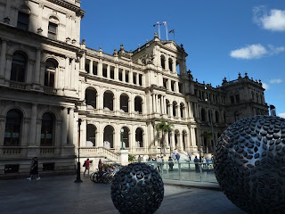
We spent most of the day doing a walking tour of the centre. Brisbane is full of familiar-looking Victorian buildings, as in Melbourne and Sydney, but here most of them have been refurbed for more modern pursuits – the grandest of the buildings, the former Treasury, is ironically now the city's premier casino, and the old Land Administration Building has been transformed into the finest hotel in the area.

Brisbane also has its fair share of art galleries and museums, mostly grouped along the Southbank (sound familiar?) If Melbourne's Southbank is how London would like to be, Brisbane's is how Melbourne would like to be. Along with the cultural pursuits there are a host of nice restaurants, an urban beach and a beautiful flower arbor. But the highlight here was the Whale Walk, a connecting covered walkway between some of the museums, which featured giant whales suspended from the ceiling, and piped whale calls reverberating around the space. I guess you had to be there, but James and I had a lot of fun practising our whale calls (his is better than mine). We also really liked the QUT (Queensland University of Technology) Gallery, which was small but perfectly formed, boasting a display on the Japanese influence on western art.

Wanting to escape the biggest backpacker hostel ever (60+ rooms) we decided to go to the cinema to see Inception. I am sure most of you have seen it by now – we both really enjoyed it, even if it was a little bit too clever for its own good. However, I was properly freaked out on the walk back, convinced there was a couple following us all the way (a good half hour walk through deserted suburban streets with no street lights). Turns out they were staying at the same hostel as we were......or were they?!

Man make fire

Monday, July 26, 2010 by Sarah

During our stay with Kate and Tim, we spent two nights in a fantastic cottage in the Blue Mountains, a couple of hours' drive from Sydney. The cottage was on the outskirts of a town called Katoomba and was a proper rustic getaway, complete with a log fire (which, predictably, the boys loved) and a balcony giving stunning views of the surrounding area, especially at sunset.

The Blue Mountains were not what I expected at all. They aren't in fact mountains, but a series of high gorges and deep canyons filled with eucalyptus trees. They're called the Blue Mountains because when the eucalyptus trees respire their moisture has a bluish tinge, which gives the whole area a misty ethereal feel.

We spent a fantastic 2 days and 2 nights walking, cooking and making the most of the fire. Whilst it was pretty cold, we were really lucky with the weather: it was sunny and clear, giving us epic views throughout. Thanks to Tim's generous wine supplies we also got through a considerable volume of red and white grapes, fortunately remaining hangover-free. Although I did think I was hallucinating at one point when, 40 minutes into a walk, we stumbled upon a small group of teenage boys 'making a short film' at the top of a waterfall. The plot seemed to involve two of the boys wearing capes and pointing at each other. Coming soon to a cinema near you, no doubt.

For the first 25 years of the English colony in Australia, the Blue Mountains were a problem – they acted as a barrier to inland expansion. It was only in 1813 that 3 men (Gregory Blaxland, William Charles Wentworth and William Lawson), managed to break through to the other side. Having started as an obstacle to overcome, by the 1930s they had become a destination to escape to. Since then people have been coming for weekend breaks, and so a number of villages have grown up to cater for the tourist trade. Katoomba was full of nice cafes and delis, where we stopped to pick up supplies of Tim's beloved snag jam (or slag jam, as it has since been rechristened) and drink hot chocolate (for the girls) and strawberry milkshakes (for the boys). Blackheath was a small-time town, but it did boast the most amazing antique store you have ever seen: a ramshackle warehouse sprawling across two levels, selling everything from vintage clothing to furniture to books with such gripping titles as 'Confessions of a Lesbian Ex-Nun' and 'The Most Dangerous Places to Visit on Earth,' which James very nearly bought, just in case we ever decide to visit the Democratic Republic of Congo or Iran.

Premium living in Sydney

Friday, July 23, 2010 by Sarah
We were both incredibly excited about heading to Sydney because it meant seeing Kate and Tim, almost a year after they moved down under. Kate and I had a suitably emotional reunion at the airport, complete with Love Actually style running and hugging.

We spent our first evening catching up and seeing first-hand the super-premium lifestyle these guys are now enjoying over here. They live in a 5th floor penthouse flat, complete with a balcony that stretches the length of the apartment with incredible views over Sydney's CBD, and his and hers rain head showers. We were seriously impressed, and after 2 whole weeks of backpacker hostels since our stay at the Four Seasons, we were very much looking forward to enjoying a bit more luxury, albeit only for a few days.

Sydneysiders, as they like to call themselves, appear to be even more fitness-obsessed than their Melburnian cousins. Everyone we saw was running or heading off to a tennis lesson or going to yoga or swimming in the open-air pool. Little wonder when you consider the weather and the scenery – both James and I attempted the local 5km running track, which loops around the Opera House and gives stunning views across the harbour. With scenery like this, it's hard to find an excuse not to exercise.

The Harbour itself is pretty incredible – I wasn't quite prepared for how impressive a sight it is. On our first evening in town, Kate and Tim took us down to the Opera House for drinks and a wander around. By night it's good, but by day it's even better. The combination of the Opera House and the Bridge is a pretty special one. The Bridge was built in the 1920s (it finally opened in 1932) to connect the northern business district to the centre of town, and the Opera House was designed in the 1950s by architectural competition-winner Jorn Utzon, who has actually never seen the place completed – owing to 'creative differences' he walked off the project during construction. Across the way are The Rocks, the original site of Sydney town. Formerly these slums were rife with drunkenness and disease, but they have been transformed into a super-premium shopping and dining district, largely for cruise ship passengers.

So far, Sydney was looking like a pretty great place to be. But it gets even better. Sydney is within spitting distance of countless incredible beaches. On our first morning we took the ferry across to Manly, which gave us more amazing views back over the harbour. Manly is less than an hour away from the CBD by boat, and this is by the way, many people's COMMUTE to work in the morning. It feels like you're in another world, or at the very least, on a long weekend's holiday. No wonder everyone in Sydney is so cheerful. At Manly's heart is its surf club, which on a Saturday afternoon was filled with children learning to become lifeguards, and parents either in the water helping to teach them or looking on proudly from the sidelines, latte in hand.

We spent the following morning at the famous Bondi Beach. In our heads it was a separate beach town near Sydney, but in fact it's very much part of the city itself, and only 20 minutes from Kate's place. Despite the cold weather, we decided we couldn't let the opportunity of swimming pass us by, and so the 4 of us stripped down to our bikinis and ran into the freezing cold water for a splash around. It was pretty refreshing, I must say!

Sadly Kate and Tim had to go back to work at some point, and so James and I spent a couple of days exploring the local sights solo, of which there are many, it must be said. We really enjoyed the MoMA museum – James was still feeling a little starved of modern art, even after Melbourne, and this definitely filled a hole, especially as the Biennale was still being shown. We also scared ourselves silly at the Aquarium, getting up close and personal to sharks, stonefish and blue-ringed octopus.

One of the highlights of our stay (and it must be said, of the trip so far) came right at the end of our sojourn in Sydney, en route to the airport. Courtesy of the lovely people at James's work, we were able to book ourselves a private helicopter flight over Sydney Harbour. Considering neither of us had ever been in a helicopter before, we were both remarkably calm about going up in the air in little more than a small tin bubble. Whilst the initial feeling of taking off was a little odd, this was quickly forgotten as we became absorbed by the views. We flew over the Harbour Bridge, around the Opera House, up to Manly and then back down along the coastline, passing Bondi en route. James and I couldn't stop grinning at each other.

Tassie Road Trip Day 5: Queenstown to Hobart

Saturday, July 17, 2010 by Sarah
We wake up bright and early and leave Fawlty Towers and the 'town that time forgot' behind. As we drive out of town, we pass a tourist information board which says “Queenstown is like nowhere else on earth.” They got that about right. It does look pretty from the top of the hill though.

We drive the windy (pretty much every road in Tasmania is windy) Lyell Hwy in the early morning sunshine, wending our way across the countryside.

After a couple of hours drive we arrive at Lake St Clair, the other half of Cradle Mountain National Park. It is so early we interrupt a couple of wallabies breakfasting on the edges of the public area. Despite this, we are still not the first people into the park – another very enthusiastic couple beat us to that title. Second in doesn't seem so bad.

St Clair is usually the finishing point for the Overland track, so a lot of the walks here are a minimum of a day long. Since we have a flight to catch at 5pm, we opted for a few of the shorter walks through the local area, which give great views of the lake. We also take the opportunity to search for platypuses which apparently fish here, but we don't spot any at this time of day.

We continue our journey onwards. The friendly bottle-shop owner we met last night told us to look out for the “Hungry Wombat” for a great lunch, which is situated just after the “mighty Derwent Bridge.” We were expecting great things – what we actually found was a greasy spoon cafe (albeit with delectable-looking cakes) just after a mini-bridge. It barely qualified as a bridge to be honest. However, considering this was also the guy who described Hobart (population 200,000) as “The Big Smoke,” I don't really know why we were surprised.

It being a little early for lunch anyway, we decide to press on to Hobart. And what a good decision it was. The sun was shining as we enjoyed fresh fish with a glass of wine on the Elizabeth St Pier, overlooking the marina. Bliss. If this is an Aussie winter, then bring it on!

Tassie Road Trip Day 4: Launceston to Queenstown

Friday, July 16, 2010 by James
After an early start in Launceston, we drove out of town with the morning 'rush hour' (two other cars on the highway) and west to Deloraine through icy valleys full of mist and cows. Strangely sinister.

From Deloraine we left the safety of the main roads and began our windy ascent towards Cradle Mountain. Cradle Mountain-Lake St Clair National Park is perhaps the most famous tourist attraction in Tasmania due to the Overland Track – an 80km, 6 day hike south through snowy mountains, moorlands and temperate rainforest – which is regarded as one of the best hikes in the world. We didn't have the time, weather, inclination or fitness for the hike itself, but in our circuit of Tasmania we were able to visit the start and finish of the route.

Cradle Valley is always a couple of degrees colder than the lowlands, so Sarah and I spent a frosty 5 minutes in the Visitors Centre car park, hopping around to keep warm by the boot of the car, putting on all the clothes we had in our backpacks. There are a number of day walks at the Cradle Mountain end of the Overland Track, so we decided to do the 3 hour walk around Dove Lake which sits beneath the park's namesake mountain. It rains 7 days out of 10 in Cradle Valley and is cloudy 8 days in 10, so we were very lucky with the weather, catching a glimpse of the 'baby in a cradle'-shaped summit as it briefly emerged from the clouds.

Back once more on windy roads and refreshed after the bracing mountain air, we drove down deeper into the west coast wilderness. The west of Tasmania is still the most underdeveloped part of the state – the small towns that hunker down into the base of the valleys exist only to serve the mining and logging industries. Strahan (pronounced 'Strawn' for some reason) is the exception, due to its location on the side of the Maquarie Harbour – one of the first harbours and site of the first penal colony in Tasmania. It was discovered by sailors in the 1800s looking for Huon pine – a valuable hardwood – and its relative inaccessibility (both from land and sea, through the treacherous 'Hell's Gates') led to its being used as a penal colony. From 1821 to 1834 (when Port Arthur was founded) prisoners on the tiny Sarah's Island worked 12 hour shifts, logging and working timber outside in the rain and cold.

In the summer Strahan must be a tourist machine, but on a rainy winter's day there's not much going on. We had a hot chocolate in a cafe by the marina, admired a rainbow that had materialised in the rain, then left. As we couldn't do the boat tour to Sarah's Island we drove out to the head to see the Hell's Gates, parking in what must be the most depressing campsite in the world. Standing on the beach, staring across the narrow entrance to the harbour and its churning brown waters you could see how intimidating the sea-route would be for any potential convict escapees. A beautiful sunset distracted us from the fast encrouching tide which snapped at our heels as we retreated to the warmth of the car.

In one final hour of driving, we sped back through Strahan and over a mountain pass (in the dark – more fun driving!) to Queenstown and our hotel. We stayed in 'The Empire,' a formerly decadent, currently decaying vestige of Imperial pretention. Climbing the grand creaking staircase to the first floor you are greeted with a horrifying 6 foot tall painting of Queen Elizabeth. Damp had eaten at the oils and her face seemed to be rotting – a zombie queen. This was all a bit too much for Sarah after our Port Arthur ghost tour, and I had to act as a supernatural bodyguard for the night - escorting her down the darkened corridors on bathroom trips.